Jim Gerweck wrote:
quote:
This year's course would have been ideal for Norm Brand's "Eye in the Sky" method
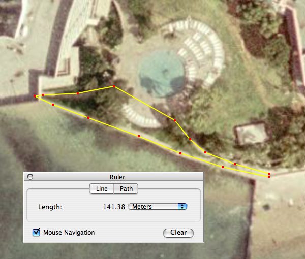
In fact, I attempted the ultimate 'eye in the sky' method--Google Earth--but abandoned it after noticing that some key points were obscured in the visible imagery. Here is a screen capture from Google Earth of the contest course behind the Sheraton Waikiki:

Note that trees obscure the turns in the pool area, but more importantly, the hairpin turn defining the west edge of the course is obscured by the hotel roof (this happens because the photo in Google Earth wasn't shot from directly overhead, but from a point somewhat northward of straight overhead).
In the above screen capture, I've tweaked the points so as to obtain the exact "true" distance of 141.38 m. But when I tried it in Google Earth the first time, I got slightly over 137 m (about the same as Gene got by pacing). I abandoned that answer when I realized that the hairpin turn was obscured, so I went out and paced the course (in the rain) and turned in an answer that was slightly worse on the high side than Gene's was on the low side (and, of course, Carole's answer was better than both Gene's and mine).


