As a certifier I received maps of this type, but found that most people simply drew in the roads and ran the measure line down the middle, just as in Mark’s example. This resulted in an attractive map, but one which contained no more information than an ordinary single-line map.
As I measure the vast majority of my courses using the Shortest Possible Route (SPR) I find that a single-line map serves me well. It’s an allowable option. Our measurement manual, Course Measurement Procedures, shows an example of a single-line map on page 60.
The advent of Google Maps is a powerful tool for would-be mapmakers. I use it to prepare a background map which covers the entire area of the course. On this background I use PhotoShop to trace the streets where the course goes. I add inserts to describe start and finish.
When I’m done I adjust the brightness and contrast so that the traced line remains dark, but the background map fades a bit. I add street names because they are sometimes too small on the background map.
When I am done I have an electronic map in color, but which will print in black and white.
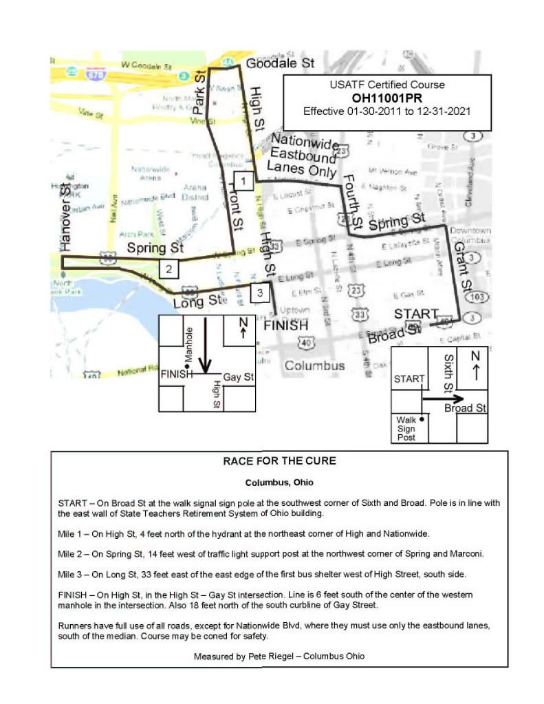
Below is an example. I cut the image in half vertically, converted the right side to black and white, and stuck the halves back together. The left-hand half of the map is how my electronic version looks. The right half is how the map looks when printed on a black and white printer. All the paper copies I generate are black and white, but I send the color version to the race director so they can have things either way they like.
I think having the area map as a dim background helps the viewer visualize things better than when the background is omitted. Also, the resulting map is to scale.
Also, the process takes a lot less time than drawing a map showing widths of roads.