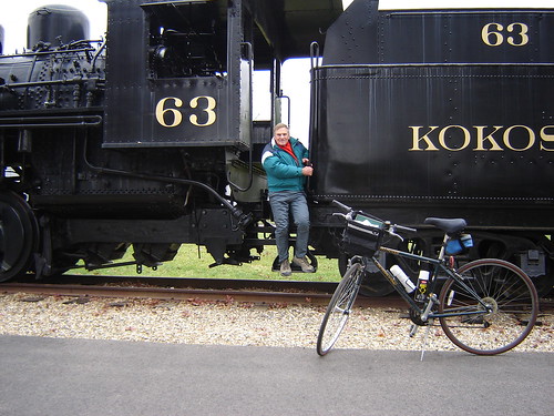
The weather last weekend was tolerable, with iffy predictions for snow or rain, but I did get a chance to go to Gambier and measure the marathon course. I met with the RD, got some questions answered, and laid out the cal course. There was a great spot for it, right next to the locomotive on the Kokosing Gap Trail, where the course begins its final out-back. It’s shown below:

Calibration course begins at the lamp post by the bike rack and goes straight past the engine.
Friday I measured from the locomotive eastward to the start, and back again. This stretch includes the loop through Gambier, which has one big hill. It was a toughie, especially when I had a couple of off-course moments and had to retrace and ride the hill again. So I got four trips up the hill.
I would have gone again Saturday to finish the job, but the Ohio State – Michigan game was the diversion of choice. Go Bucks.
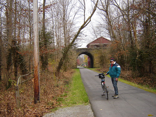
Sunday was an easy out-back from the locomotive to the east end of the course in Danville, and I was pleased to see that there were a couple hundred meters to spare. I’d been painting splits as I went east, and would have been grieved to have to change them. Enroute I passed through a short tunnel:
I was happy to be done with the riding before the snows came. Once these bike paths get snow-covered, they generally don’t get plowed, and I hate to have half-finished work sitting around.
Couldn’t resist a final tourist shot:
Now for the course map and the paperwork. I can't remember a marathon course that was more fun to measure.