&searchp=ids.srf&mapp=map.srf]London Map
View the map in 1/25000 at the above site. Here is a section of the map with three elevations shown. They were taken from Google Earth, and are in feet.
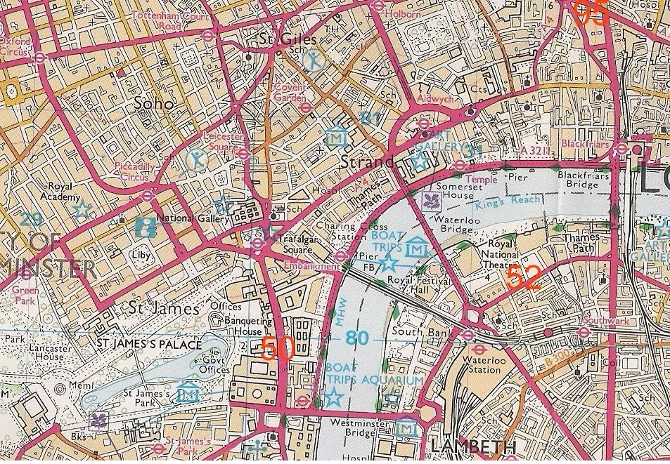
Note the three elevations appearing in red. They were obtained using Google Earth. To the left of each red elevation is a figure which shows the elevation in meters, according to the Landranger 1/25000 map. There’s quite a discrepancy.
Mike Sandford and I have been kicking this around. He converted my readings to meters and said:
OS map * Google * so google sea level datum is lower by
16 meters * 29 meters * 13 meters
2 meters * 15 meters * 13 meters
4 meters * 16 meters * 12 meters
The Thames moves up and down with the tide, and the Embankment, which borders the Thames, is considered to be about 5 m above mean sea level.
These are the biggest differences I’ve seen between Google and a trustworthy map.
Check it out! Any thoughts?