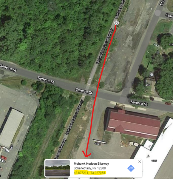
Another method for getting Lat/Long coords (in decimal degrees) for cal course ends is to:
- Locate the course on Google Maps (use Satellite view as the Map Type)
- Right click on one end of the course (your best guesstimate) and the street and coords appear in a pop-up box at the bottom of the screen
- Highlight and copy the coords for that point
- Paste as text into file
- Repeat steps 2-4 for the other end
Here's an example from NY21004JG